See It in Action
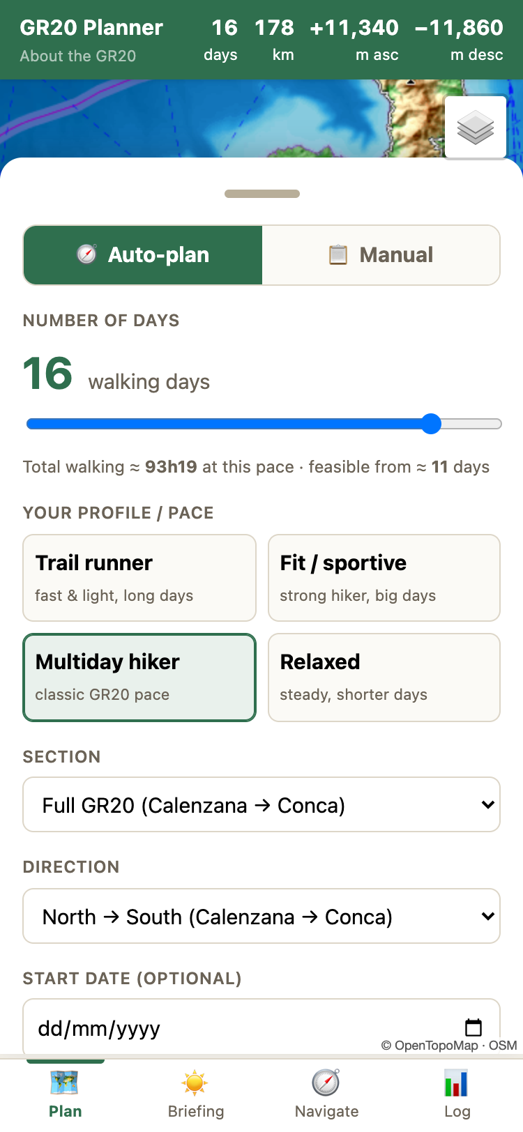
Plan your stages
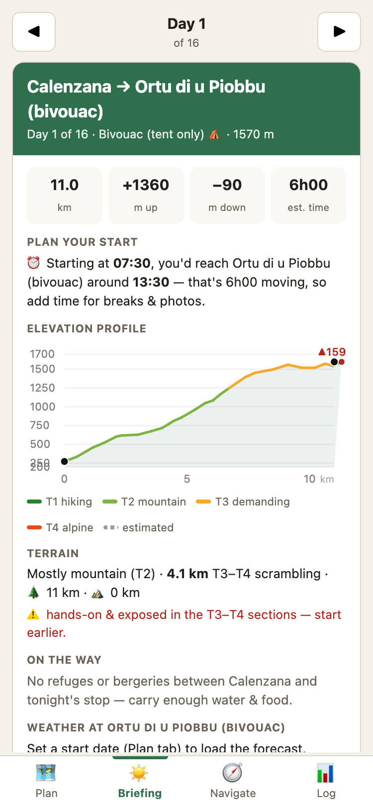
Morning briefing
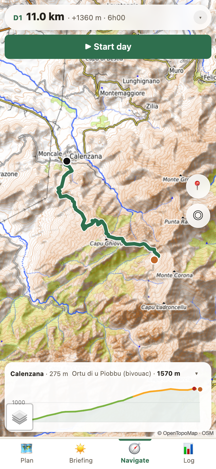
Live navigation
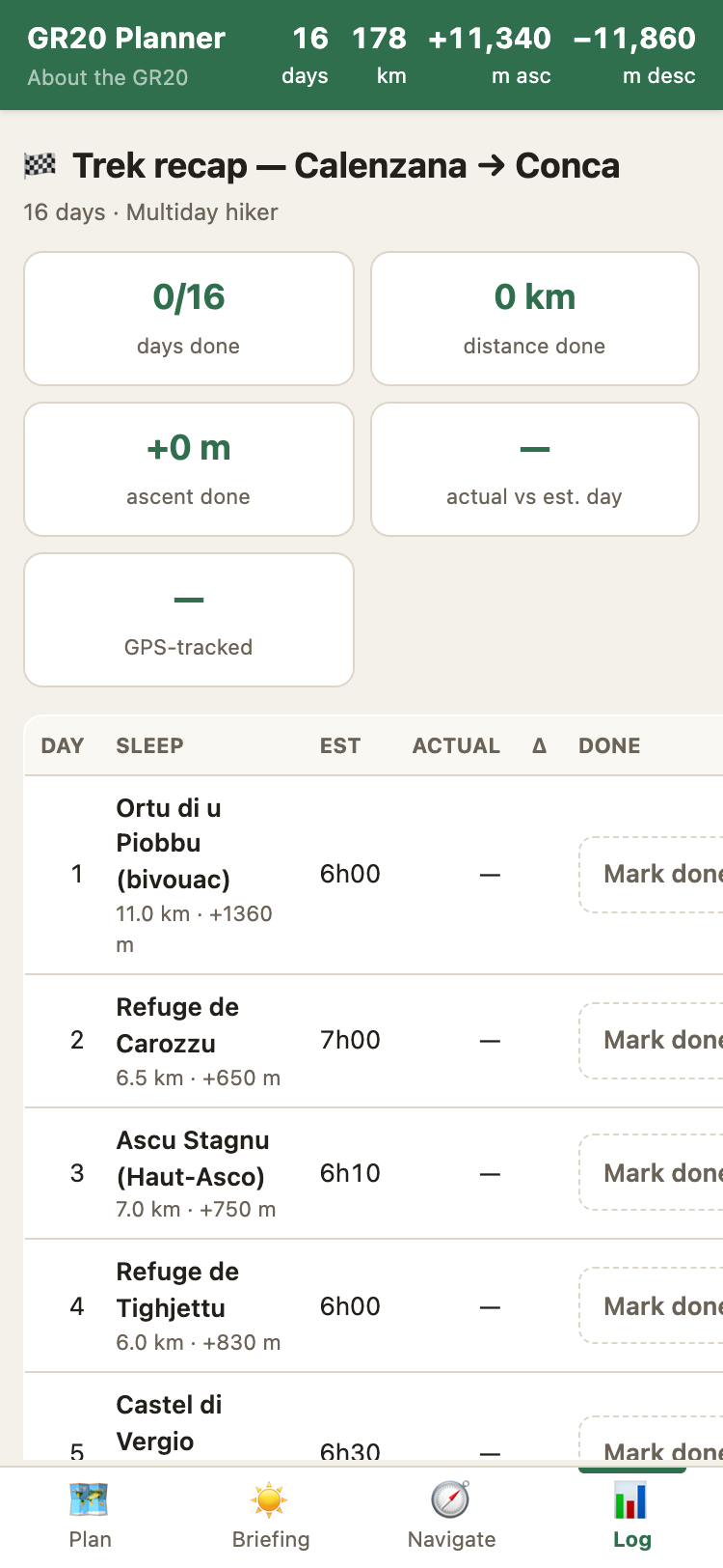
Trip log
The free route planner for Corsica's legendary trail. Set your days and fitness level, get optimal refuges, offline maps, live GPS navigation and daily morning briefings.
From planning at home to navigating on the mountain — one app, fully offline.
Set your available days and fitness profile. The algorithm distributes stages optimally across refuges and bergeries. Or build your itinerary manually, including rest days.
Download the complete trail map for offline use. Topographic contours, all refuges, water points and resupply options — works without signal.
Real-time position on the trail with direction arrow, off-trail warnings and distance remaining. Battery-saving mode for multi-day use.
Each morning: today's distance, elevation, estimated arrival, weather forecast, water points and waypoints. Plus your booking reference at a glance.
See terrain difficulty for every stage. Color-coded by gradient with technical sections highlighted. Know what's ahead before you start.
Every refuge, bergerie, gîte and bivouac — including the lesser-known ones. Tap any stop for location info, booking links, distance from the previous stop and what to expect.